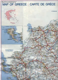
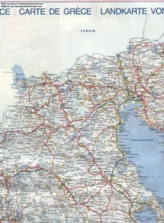
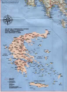
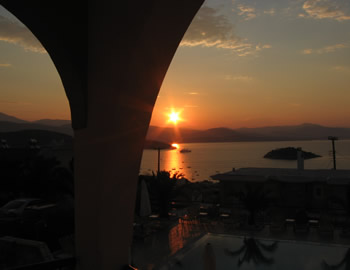
The country of Greece is located in southeastern Europe, on the southern end of the Balkanic peninsula. Greece is surrounded on the north by Bulgaria, the FYROM and Albania; to the west by the Ionian Sea; to the south by the Mediterranean Sea and to the east by the Aegean Sea.
 Where is Greece
The country ranges approximately in latitude from 35°00′N to 42°00′N and in longitude from 19°00′E to 28°30′E. As a result, it has considerable climatic variation, as discussed below.
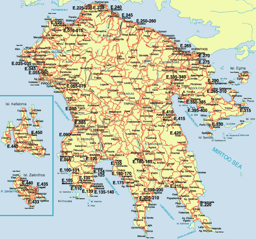
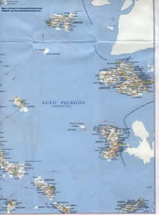
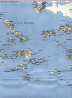
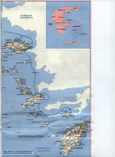
Islands of Greece
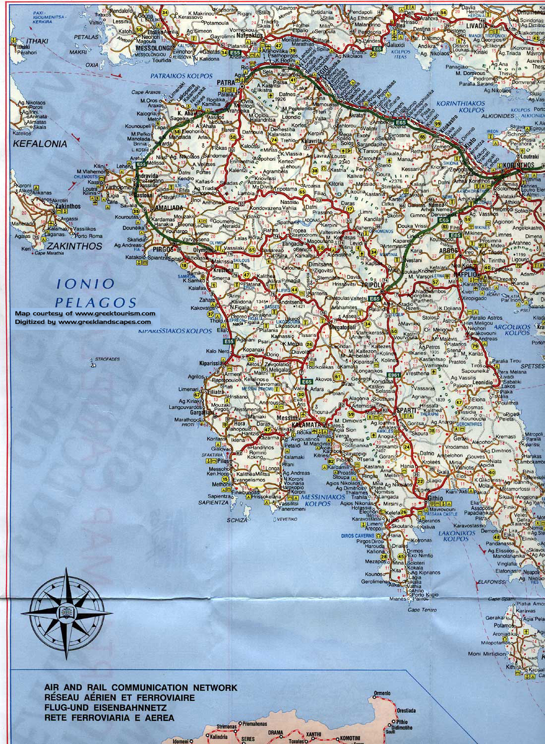
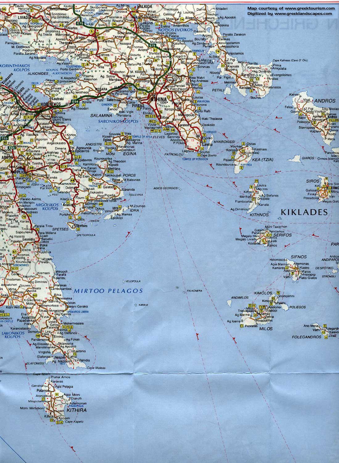
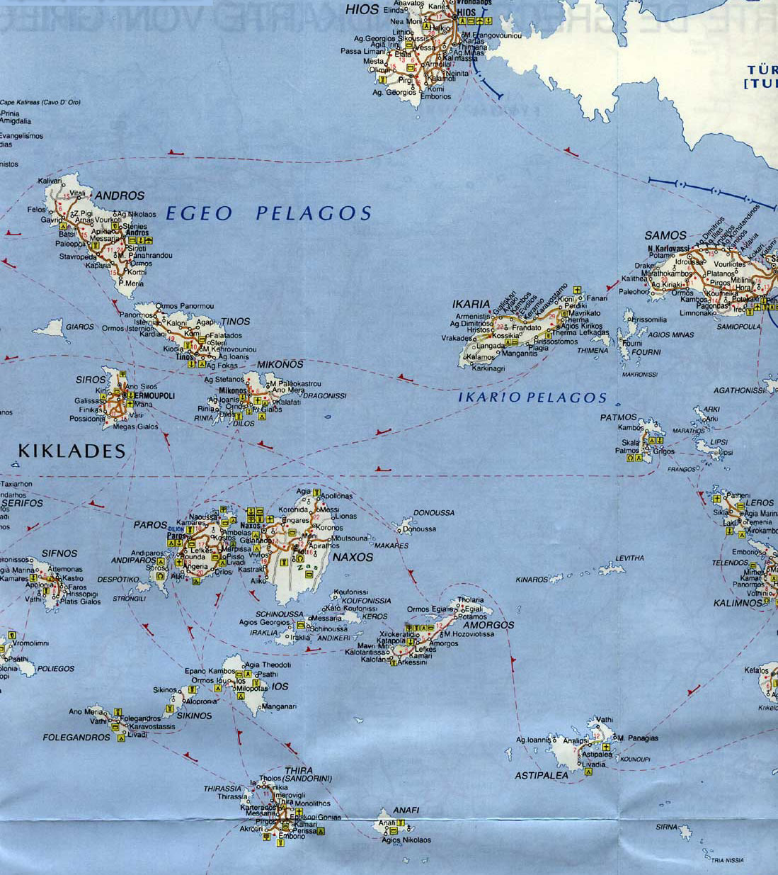
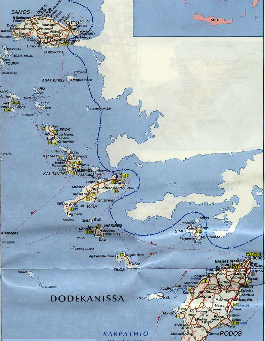
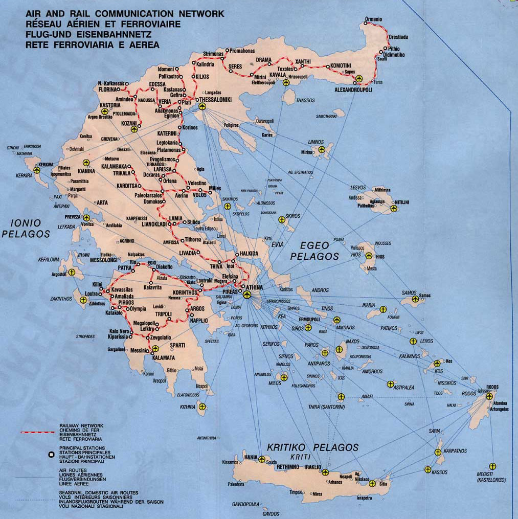
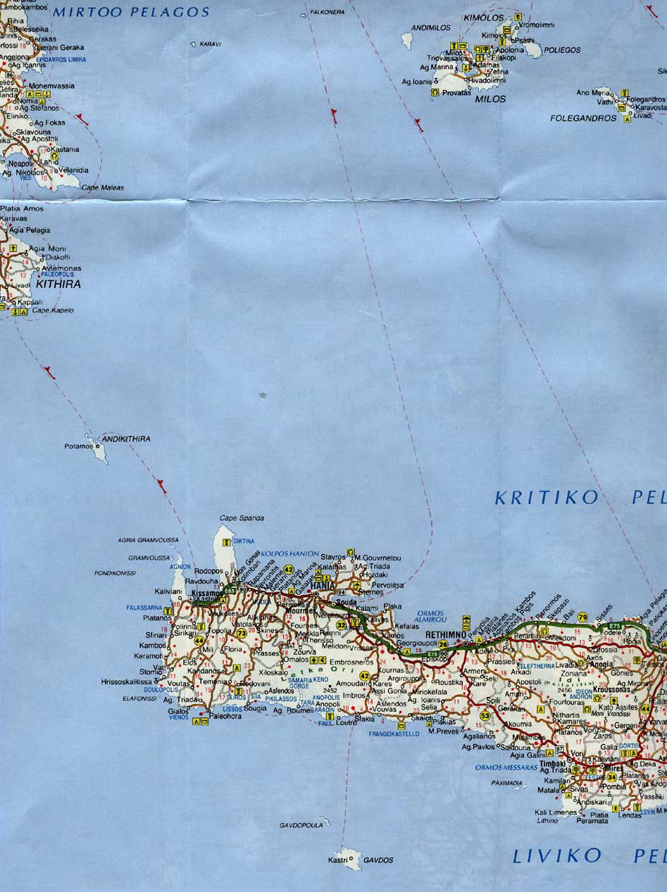
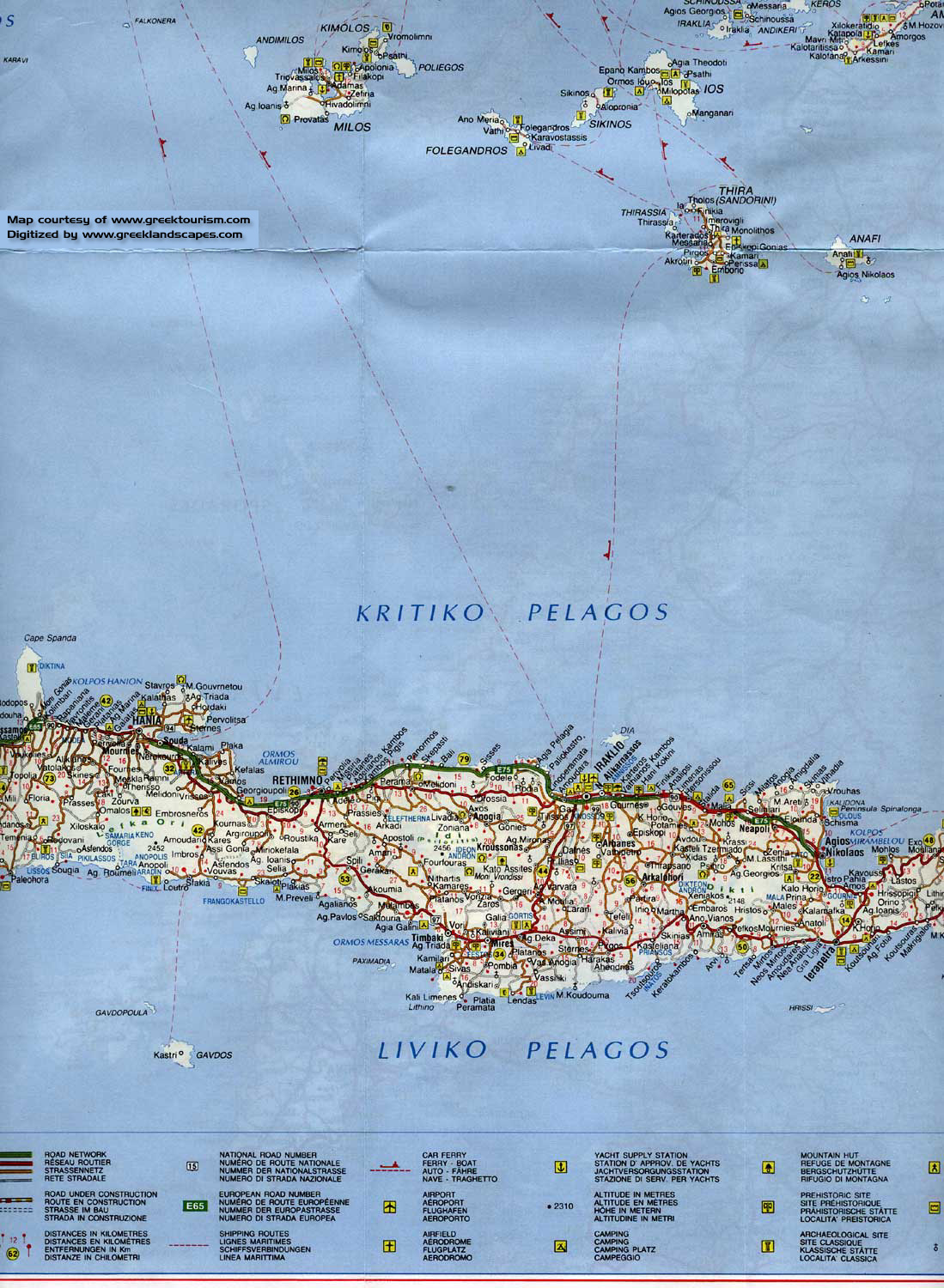
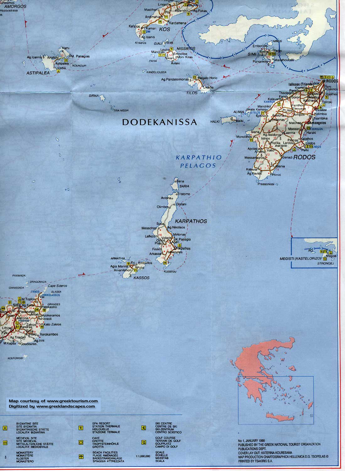
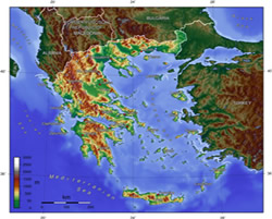
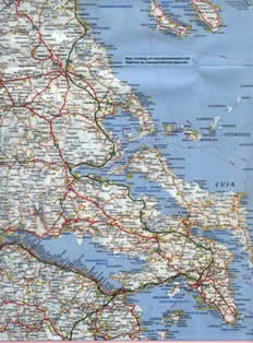
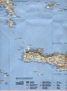
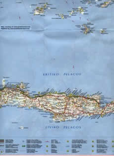
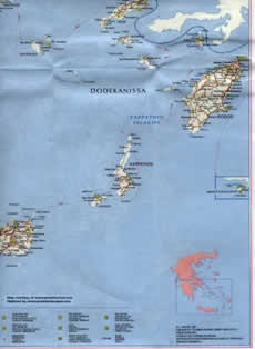
The country consists of a large mainland;the Peloponnese, a peninsula connected to the mainland by the Isthmus of Corinth; and around 3000 islands, including Crete, Rhodes, Corfu, the Dodecanese and the Cyclades. Greece has 15000 kilometres (9300 miles) of coastline. 80% of Greece is mountainous, and the country is one of the most mountainous countries of Europe. Western Greece contains lakes and wetlands. The Pindus Mountains lie in the country's centre, with an average elevation of 2650 m. They continue as the islands of Kythera, Antikythera and end in the islands of Crete and Rhodes.
Greece landscape
The islands of the Aegean Sea are peaks of underwater mountains that are a geological extension of the Pindus. Central and Western Greece contain high and steep peaks dissected by many canyons and other karstic landscapes, including the Meteora and the Vikos Gorge - the latter being one of the largest of the world and the second deepest after the Grand Canyon, plunging vertically for more than 1100 meters. Mount Olymus Greece (Mytikas) is the highest point of Greece and the fourth highest in absolute altitude in Europe, rising to 2919 m above sea level. The Rhodope Mountains form the border between Greece and Bulgaria; that area is covered with vast and thick forests. Plains also are found in Eastern Thessaly, in central Macedonia and in Thrace
Facts about Greece
On a very broad scale, Greece can be divided into two environmental regions:
the sub-continental northern part, and
southern or Mediterranean Greece and its islands.
Another way to describe the country is to divide it into five major traditional and geographical regions:
Greek Thrace and Macedonia along the northern border and fronting on the northern Aegean Sea;
Northern Peninsular Greece composed of Epirus to the west on the lonian Sea, and Thessaly to the east on the Aegean;
Central Greece extending south to the Gulf of Corinth and including the Athens area;
Peloponnesus or southernmost Peninsular area, and
Insular Greece, a fringe of islands some widely separated from the mainland.
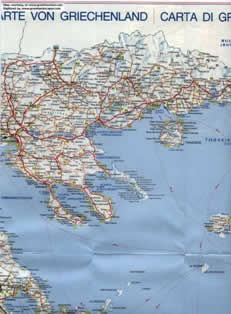
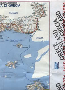
Thrace and Macedonia. Thrace, the northeastern corner of Greece, is separated from Turkey by the Evros River and from Macedonia to its west by the Nestos River. Its northern border with Bulgaria runs through the Rhodope Mountains. Partly plateau and partly lowland, in addition to its two major rivers it has a large lagoon, Porto-Lago, connecting with Lake Vistonis, on its Aegean coast. Macedonia, lying between the Nestos River and the Albanian border, shares its mountain ranges with former Yugoslavia and Bulgaria and has important agricultural areas. Its major rivers are the Strymon, Axios and Aliakmon. Its major city is Salonika, the second largest city and port in Greece.
Northern Peninsular Greece. Its western section, Epirus, is an isolated area of high mountains of folded sandstones and limestone, poor uplands, and karst. On the windward side of the Pindus Mountains, it has high rainfall. Its soils are poor, but Epirus has some good areas for trout culture. To its east, and extending to the Aegean, is Thessaly which consists essentially of two basins linked by the Penios River. Its plains are the most important agricultural lands in Greece, constituting both granaries and cattle raising regions.
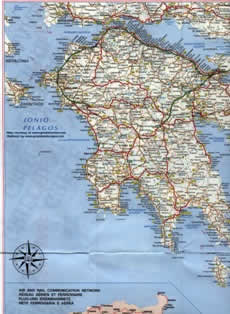
Central Greece. To the south, and extending to the Gulf of Corinth, is a more Mediterranean area, characterized by olive rather than oak trees. This region of plains, foothills, mountains, and rocky coasts supports the largest city and port area of Greece, the Athens-Piraeus complex.
 Peloponnesus. Separated completely from the upper peninsula by the Gulf of Corinth and Corinth Canal, this is a mountainous area of few lowlands and a narrow indented coastal fringe. Partly karstic with underground drainage, its rivers, including the major Evrotas and Alphios, go dry in the summer.
Insular Greece. The 1 400 Greek islands are widely distributed throughout the surrounding seas, occupying 24 796 km2 (almost 20 percent) of the total area. Crete, the largest island (8 336 km2) is the fifth largest island in the Mediterranean. Other large islands are: Euboea (3 654 km2), the largest island in the Aegean; the two largest lonian islands, Cephalonia (781 km2) and Corfu (542 km2); Lesbos and Rhodes. Many of the lowland areas of Greece were once swampy and malarial. They, along with many of their shallow lakes, have been drained.
Although largely depleted, forests still occupy a fifth of the country. Aleppo pines and mixed deciduous trees (oak, beech and chestnut) are at lower altitudes, and conifers such as spruce are at the highest altitudes. Large areas of maquis (macchia) dominate the country, and much of the vegetation has been denuded.
Included within the great variety of soils, fissured limestone rocks prevail, followed by sandstone, crystalline rocks, and conglomerates. Mountain soils are thin, and strong karstic formations exist in many regions.
Most of the people live either in the large cities, such as Athens-Piraeus and Salonika, or in small scattered villages.
 The Hellenic Republic, southernmost of the Balkan countries, lies between the Mediterranean's lonian and Aegean Seas. Although sea-oriented and sea-girt, with a galaxy of islands, it is primarily a mountainous country. Much of Greece is barren, eroded, and deforested, dissected by small rapid rivers and enclosing a few isolated basins.
Its greatest length (E-W) is 992 km, and its greatest breadth (N-S) is 793 km. Its altitudinal range is from sea level to 2 917 m on Mt. Olympus. About 67 percent of its area is above 200 m, and about 13 percent above 1 000 m.
Greece is bounded on the northwest by Albania for 247 km, or the north by former Yugoslavia for 256 km and Bulgaria for 475 km, and on the northeast by Turkey for 203 km1/. A peninsula, its western flank is bathed by the lonian Sea, its eastern flank by the Aegean Sea.
About one fifth of its area is composed of more than 1 400 islands, of which less than 200 are inhabited. The sea cuts very deeply into the land to form an extremely long coastline. With islands excluded, the coast is about 2 700 km; with its islands it is about 15 021 km long, an extent surpassed by few other countries.
About 80 percent of Greece is mountainous, a southern continuation of the rugged mountains of Albania, former Yugoslavia and Bulgaria. Intermontane basins, valleys and plains, mostly covered with sands, marls and clays, make up 20 percent of the country.