The Serra da Estrela (English: Mountain range of the Star) is the highest mountain range in Portugal and includes mainland Portugal's highest peak (Pico mountain in the Portuguese Azores islands is higher), which has a natural altitude of 1993 m (around 6541 feet). 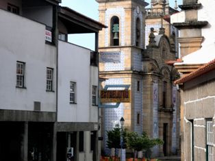 However, in 1716 - 1726 the Portuguese king João V ordered the construction of a 7 m tall tower so that the peak could reach 2000 m. The location of this tower is known as "Torre" ("Tower", literally translated). The mountain range is about 100 km long and is 30 km at its widest point. It is formed from a huge granite ridge.
Situated in the largest mountain range in the country, the Serra da Estrela Natural Park is the source of the rivers Mondego, Zezere and Alva. More than half of its area is located above an altitude of 700m and it is here, at 1993m, that you will find the highest peak in continental Portugal.
During the Quaternary period, all the region was subjected to the action of ice and once this disappeared visible marks were left on the landscape. Valleys in the shape of horseshoes, ravines, polished rocks and lakes of glacial origin are just some of the formations that demonstrate the importance of the ice and snow in modelling the mountains.
The central plateau, dominated by the Torre and Cantaros, location of the glacial valley of the Zezere, contrasts with another mountain, the Videmonte plateau, which is still in the initial bed of the Mondego, dotted with isolated farms among fields of rye and pastures where cattle are bred. In the valleys to the south west, decorated by terraces and surrounded by the Penha dos Abutres, are the villages of Loriga and Alvoco, which have developed on powerful rocky spurs. Finally, the north west slope stretches from below Seia to the land dominated by the castle of Linhares and the fields where maize is cultivated and vines are planted up the slopes to where the broom grows. In terms of fauna, the admirable presence of the bear is a thing of the past and even wolves only roam here sporadically. In addition to the wall lizard that is a feature of the region, other species include otters, genets, badgers, wild cats, water moles, red breasted bullfinches, Algerian wall lizards and midwife frogs.
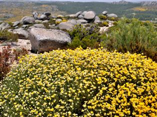
The natural vegetation appears in three separate sectors. Under 900m, in very clearly defined areas. Between 800/900m and 1600m is the domain of the black oak. From 1600m upwards, we find the juniper and the high pastures where the gentian, a plant in danger of extinction, can be found.
Hiking and skiing in Serra da Estrela Natural Park
The mountain range is now part of the Serra da Estrela Natural Park and offers plentiful skiing opportunities in the ski resort of Loriga. The Serra da Estrela is the only region in Portugal to boast a network of marked routes, which cover the whole of the Natural Park. There are three main trails.
Each of these trails takes between three to four days to complete; they are considered overall to be moderately difficult to difficult walking, as there are some steep climbs involved and long distances.
But if you want to follow a trail for only one day, starting and ending at the same place, we have two described routes for you: The Manteigas-walk starts at the pousada near Manteigas, by following a part of one of the main trails and than making a wonder fool loop around the plateau by returning via another main trail, which leads you trough the Vale do Rossim on the way back.
 The villages in the Serra da Estrela Natural Park area are mainly at the bottom of the mountains and date back to medieval times. However, before this other cultures left their mark on this area. One of the most notable examples of the Roman presence are the remains, still to be seen at Famalicao and Folgosinho, of the road that connected Merida to Braga. The route by which it crosses the mountain would certainly have caused difficulties in construction. The Arab influence is seen in the irrigation system and the fruit orchards while the Visigothic culture organized all rural space by applying the ‘Visigoth Code’. The Azinheira-walk is in a forgotten corner of the park on the bank of the Beijames River.This beautiful watershed is lined with traditional stone and wood houses, built in a loosely common architectural style that melds perfectly with its surroundings. There's a circular walk around the valley, which goes up to the waterfalls of Poço do Inferno and to the peak of Azinheira (1035m).